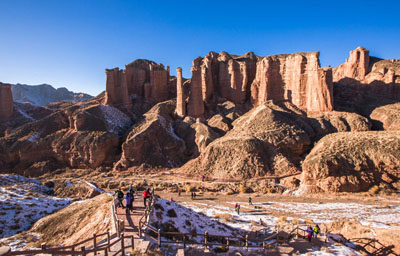
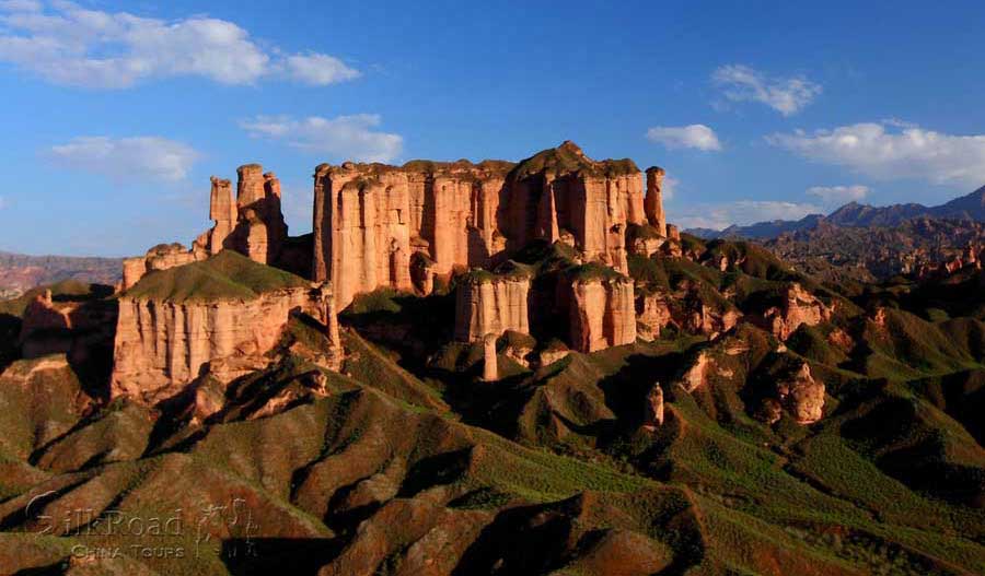
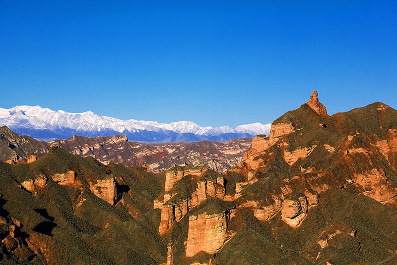
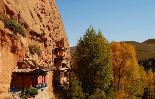
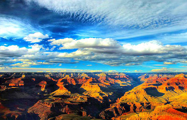
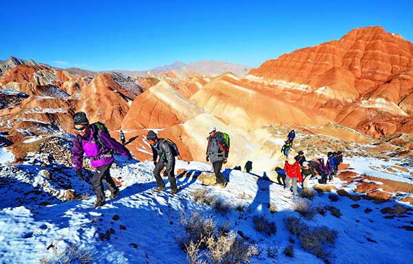
 Binggou Danxia Landform is located in Sunan Yugur Autonomous County, on the junction of Qilian Mountain and Hexi corridor, with altitude between 1500 to 2550 meters above sea level. It extends 5-10 kilometers from north to south and 40 kilometers from east to west. Covering an area of more than 300 sq km. Binggou Danxia Landform is the best Mullion-like palace style Danxia Landform in China, which has the most peculiar form and complete development in China. In 2000 Binggou Danxia Landform was nominated by National Geographic Magazine as the World's top ten magical geographical wonders.
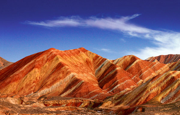
"Danxia Landform" is a broad term used to describe geological formations composed of limestone and conglomerate that have been molded through a series of specific, complex geological processes. These structures are unique to China and are characterized by their deep red hues, steep cliffs, and distinctive shapes.
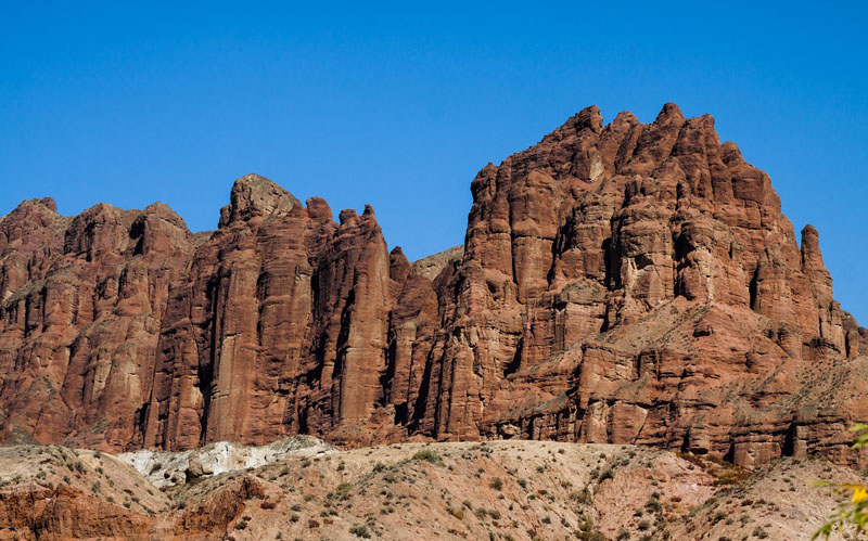
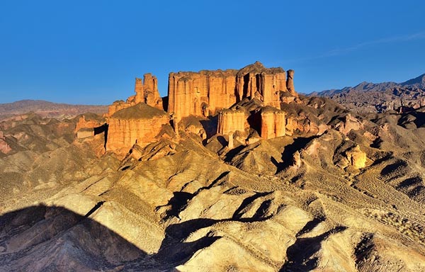
There in the Binggou Danxia Landform widespread with Danxia cliff, sandstone wall, stone stele, aiguilles and hills. Some of them look like buildings such as castle, pagoda while some look like human beings that full of life.
Danxia landforms cover several provinces in southeast China. Taining County, Fujian Province has very good examples of "young" danxia landforms wherein deep, narrow valleys have been formed. As the landform gets older, valleys widen and one gets isolated towers and ridges. The danxia landform is named after Mount Danxia, one of the most famous examples of the danxia landform. A very peculiar feature of danxia landscape is the development of numerous caves of various sizes and shapes. The caves tend to be shallow and isolated, unlike true karst terrain where caves tend to form deep, interconnecting networks. In 2010, several danxia landscapes in southern China, with a general name of "China Danxia", were inscribed as a World Heritage Site. The six inscribed danxia landform areas are: Mount Langshan and Mount Wanfo (Hunan Province),Mount Danxia (Guangdong Province), Taining and Mount Guanzhi (Fujian Province), Mount Longhu and Guifeng (Jiangxi Province), Fangyan, Mount Jianglang (Zhejiang Province), and Mount Chishui (Guizhou Province). The total core area of 6 regions above is 73945 ha, and the total buffer area is 65446 ha. Other notable danxia areas, such asZhangye Danxia National Geological Park, are not included in the World Heritage Site.
Around 80 million years ago cretaceous red sandstone and conglomerate were laid down through sedimentation of lakes and streams. After another 15 million years, tectonic plate movement exposed many faults. About 23 million ago, movement of the Himalayan range, disturbed the land around Guandong, China creating much uplift and completely changing the topography of the area. Over millions of years the steep cliffs that can be seen today were formed through weathering and erosion, exposed by faults. This geology can be seen at Danxiashan Geopark in China, where there is about 290 square kilometers of streams, forest and towering danxian rock formations.
Key Features1. Sculpted Rock Formations : The area is dominated by steep, vertical cliffs and honeycomb-like patterns carved by wind and water erosion. The most iconic shapes include natural arches, mushroom-shaped rocks, and towering spires.
2. Stratified Layers : The exposed rock layers reveal a geological timeline, with alternating bands of red sandstone and conglomerate reflecting ancient sedimentary environments.
3. Dynamic Colors : At sunrise and sunset, the iron-rich sandstone glows in fiery red and golden tones, creating a surreal visual spectacle.
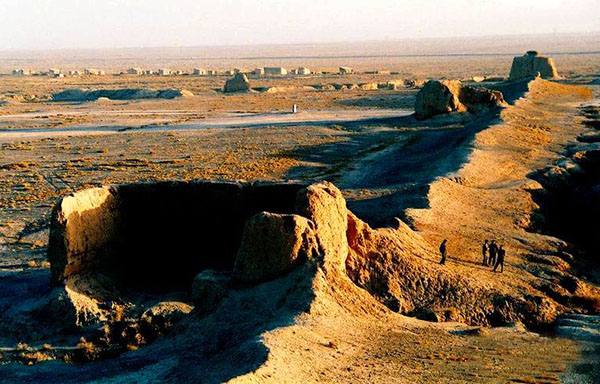
Cultural and Ecological SignificanceBinggou Danxia is not only a geological treasure but also a site of cultural importance. Nearby areas host remnants of ancient Silk Road routes and Tibetan Buddhist temples. Ecologically, the arid landscape supports hardy desert flora and fauna, adapted to the region's extreme temperature fluctuations.
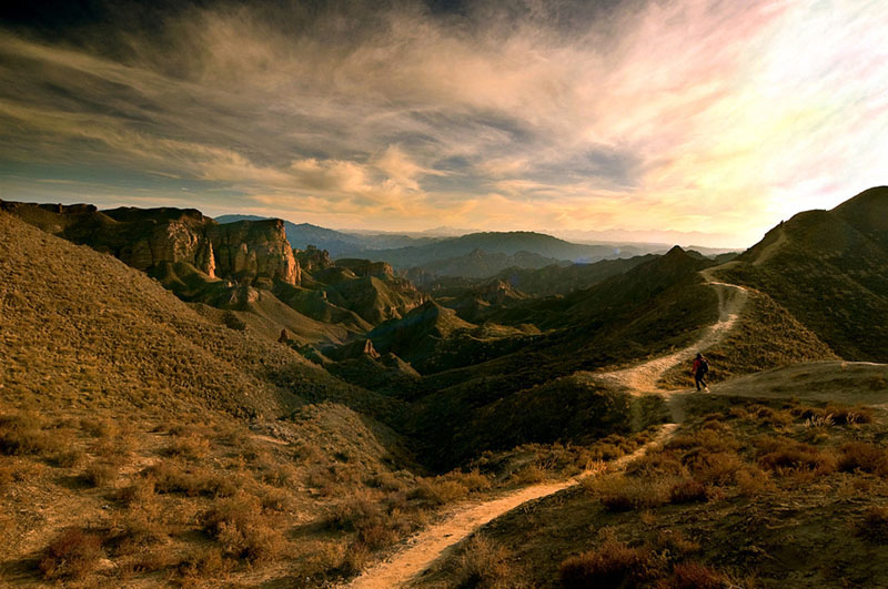
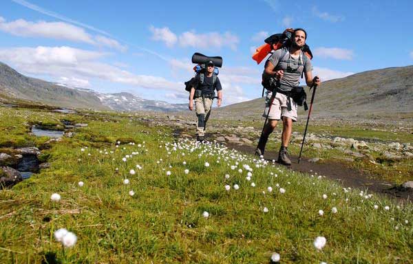
Visitor Experience- Hiking Trails : Well-maintained walkways and viewing platforms allow visitors to explore the park while preserving its fragile ecosystem.
- Photography : The interplay of light and shadow on the rugged terrain makes it a paradise for photographers.
- Guided Tours : Local guides offer insights into the geology, history, and legends associated with the formations.
Best Time to Visit The ideal seasons are spring (April–June) and autumn (September–October), when temperatures are mild. Summer can be scorching, while winter brings snow, adding a stark contrast to the red rocks.Gallery


General Information
Alias: No
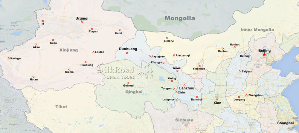
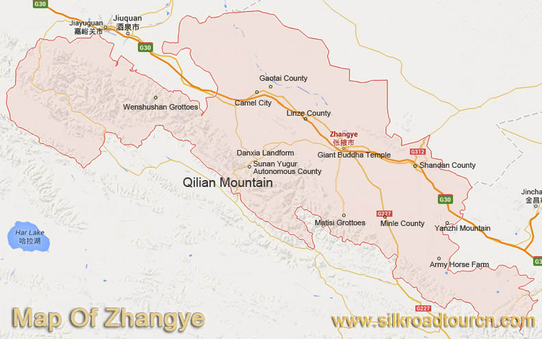
Loc: 60 km from zhangye
Entrance: 60 RMB
Open Time: 8:00~18:00
Map
Relevant blogs
-
Lanzhou Zhongchuan International Airport opened more rou
The summer rush is approaching, Lanzhou Zhongchuan International Airport scientific research and development of the air travel market, and airlines to carry out
-
"Travel to Wuwei by high-speed rail" tourist special t
On June 30, the "high-speed rail tour Wuwei" tourist train was launched from Lanzhou West Railway Station, and more than 300 tourists began a two-day "unconstra
-
China's Silk Road Turpan Grape Festival opens
On August 16, the 30th China Silk Road Turpan Grape Festival with the theme of "Turpan's grapes are ripe" opened in Turpan, Xinjiang province.Turpan has super
-
The "Silk Road Dream" international tourist train depa
On July 6, the "Silk Road Dream " high-quality railway characteristic tourist train completed renovation and officially opened in Xining city, Qinghai province.
-
Multinational Wrestling Tournament Kicks Off in Turpan,
Xinhua News Agency, Urumqi, March 8th - The 2025 China Xinjiang - Central Asia - Cuba International Wrestling Tournament commenced today in Turpan City, Xinjian
-
How did the name of Tianshui in Gansu come about?
The name Tianshui is very pleasant to the ear, and it reminds one of that exquisitely beautiful verse, "After getting drunk, one doesn't know if the sky is in
Tags
Silk Road China Tours -
Reliable travel agency based in Dunhuang, China. We focus on providing customized tours across Silk Road in China,on your own terms and with reasonable prices.
Contact Us
Gansu, China
Phone: 0086 - 18919428669 (24h)
Tel: 0086 - 937 - 8809499 (24h)
Email: Service@silkroadtourcn.com
2005 © All Rights Reserved. Privacy & Security | Terms & Conditions